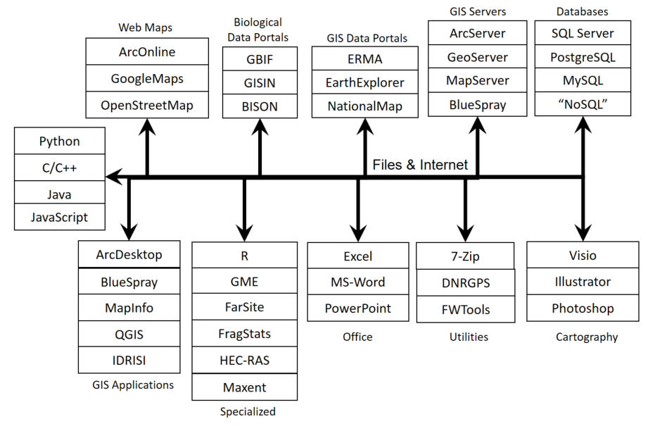
ArcGIS is a powerful tool for spatial analysis. However, it is not the only tool available. There is an ever increasing number of software tools to work with different types of data and to perform different types of analysis. The graphic below was reproduced from a slide presented at the Esri 2012 Ocean Summit.
Below is my vision of a subset of the GIS software world. In the future, there will be many more software products available both on a local workstation and on the Internet. You may be building some of these!
Note: The GIS world is expanding rapidly and the software community is not keeping up with the needs of GIS professionals. With programming, you can create your own analysis tools. This class will touch on programming in R but we also recommend taking additional programming, and specifically spatial programming, classes.
Selecting the software you will use is critical to your success. There are a number of questions to look at:
Many individuals and organizations will simply purchase a software package because it is the "standard". Others, will use an OpenSource package because they don't like for-profit products. I'm here to get work done and need the best tool for the job and it does not really matter if it is from a for-profit or a non-profit organization. Also, OpenSource software always has costs associated with training and maintenance. The really weird situation are in now is that some of the free software has better and less expensive support than software that is really expensive!
The real issue is to create and maintain the "toolbox" (a metaphor for a real toolbox) that is right for you. The set of tools you have available and your ability to use them will determine what you can do and how fast and well you can do it. You can only be good at using a certain number of tools so you need to pick carefully. You'll also want to check out new tools and see if they should be added to your toolbox. However, if you add something you'll also probably need to toss out an old tool so be careful how you choose.
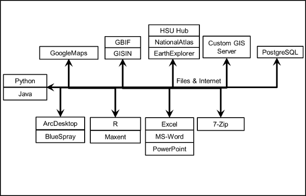
Below is the toolbox that I use. Your toolbox should start off smaller and grow over time. You may never have as many GIS-based tools as I to but you might add some new ones such as data loggers, boats, and surveying equipment.
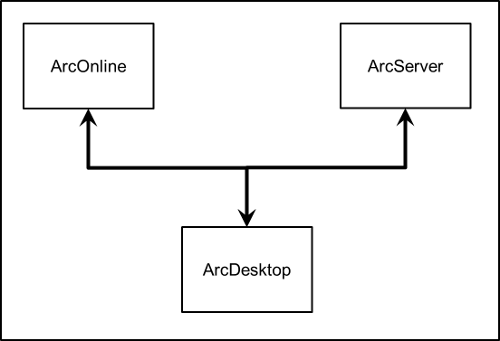
Note: We used to believe that we would largely use ArcGIS with a suite of "extensions" that fulfilled the needs of just about any GIS tasks. Unfortunately, Esri chose to change the programming interface for ArcGIS so frequently that it is almost impossible for developers to maintain the multiple copies of extensions that are required to support the different versions. This has led to a decrease in the number of extensions for ArcDesktop and an increase in the number of other GIS software packages.
Below is a growing list of the software that is available for geospatial work and some notes on why you would use one package over another.
© Copyright 2018 HSU - All rights reserved.